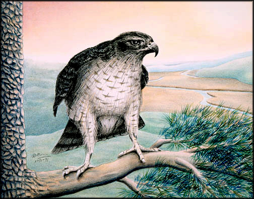
The goshawk, an elusive forest dweller, was the most appropriate subject for this piece as it symbolically represents the woodland people whose ancestral home it inhabits and now watches over. In the heart of the traditional home of King Philip’s allies, the Nipmuck, it is perched atop a high branch of a Broad Arrow Pine, one of those massive old growth Eastern white pines that were selected (and are now virtually extinct) for use as masts in colonial England’s Royal naval ships. Early accounts describe individual trees that reached seven feet in diameter and were two hundred twenty five feet in height. Until the pacific coast stands of redwoods and sequoias became known, this pine tree was considered the largest living organism on earth.
The setting in this piece is just north of Wolf’s Hill, on the Uxbridge/Northbridge, Massachusetts town line. It was dedicated in 1988 by then Massachusetts Secretary of Environmental Affairs, James Hoyte, as a “Special Place of Environmental Significance.” He remarked that it was an especially good choice for the award since it was environmentally, historically and aesthetically significant. The site looks over one thousand acres of state-owned land around the Nipmuck (now Blackstone) River Valley.
Soon after hostilities broke out in King Philip’s War, Philip left his ancestral home at Mount Hope and moved north along the eastern banks of the Taunton River, eventually crossing it near the town of Dighton. From there he moved northwest, toward northern Rhode Island, where he was attacked by the English and their Mohegan allies. He managed to elude their troops by moving along the Nipmuck River, depicted here in the background of this piece. Tradition claims that he camped at this place (today called King Philip’s Lookout and Cave) for an undetermined length of time. The great vantage point from this site allowed his warriors to keep a keen watch on the northern movements of their assailants. From here Philip moved westward toward the Connecticut River Valley, where Native forces launched their attacks on remote English settlements.
